|
| Baker,
Midway and Wake Islands |
| |
 |
 |
Baker Island:
Baker Island is an uninhabited atoll located just
north of the equator in the central Pacific Ocean about 3,100 km (1,670
nm) southwest of Honolulu. The island is almost half way between Hawaii
and Australia. Its nearest neighbor is Howland Island 68 kilometres to
the north. Baker Island National Wildlife Refuge consists of the 405
acre (1.64 km²) island and a surrounding 30,500 acres (123 km²) of
submerged land. The island is now a National Wildlife Refuge managed by
the U.S. Fish and Wildlife Service as an insular area under the U.S.
Department of the Interior. Baker Island is an unincorporated and
unorganized territory of the U.S..
Baker was discovered in 1818 by Captain Elisha Folger of the Nantucket
whaling ship Equator, who called the island "New Nantucket". In August
1825 Baker was resighted by Captain Obed Starbuck of the Loper, also a
Nantucket whaler. The name goes back to Michael Baker, who visited the
island in 1834.
The United States took possession of the island in 1857, claimed under
the Guano Islands Act of 1856. The United Kingdom advanced a claim to
this island subsequently, but this claim was invalid due to the more
previous claims made by the United States. Its guano deposits were mined
by U.S. and British companies during the second half of the 19th
century. In 1935, a short-lived attempt at colonization was begun, as
well as on nearby Howland Island. The settlement Meyerton had a
population of four American civilians evacuated in 1942 after Japanese
air and naval attacks. During World War II it was occupied by the U.S.
military.
Since the war, Baker has been uninhabited. Feral cats were eradicated
from the island in 1964. Public entry is by special-use permit from U.S.
Fish and Wildlife Service only and generally restricted to scientists
and educators.There are no natural fresh
water resources. The island is treeless, with sparse vegetation
consisting of grasses, prostrate vines, low growing shrubs, and some
scattered ruins. A cemetery and remnants of structures from early
settlement are located near the middle of the west coast. The island is
primarily a nesting, roosting, and foraging habitat for seabirds,
shorebirds, and marine wildlife. The U.S. claims an exclusive economic
zone of 200 nautical miles (370 km) and territorial sea of 12 nautical
miles (22 km). During the 1935–1942 colonization attempt the island was
most likely on Hawaii time, which was then 10.5 hours behind UTC. Being
uninhabited the island's time zone is now unspecified, but it lies in
waters whose nautical time zone is 12 hours behind UTC. There are no
ports or harbors, with anchorage available only offshore. There is one
boat landing area along the middle of the west coast. There is an
abandoned World War II runway, 1,665 meters long, which is completely
covered with vegetation and unusable. The narrow fringing reef
surrounding the island can be a maritime hazard and there is a day
beacon near the middle of the west coast. |
|
|
|
 |
 |
|
|
|
Midway Atoll:
Also known as Midway Island or Midway Islands,
Hawaiian: Pihemanu is a 2.4 square mile (6.2 km²) atoll located in the North
Pacific Ocean (near the northwestern end of the Hawaiian archipelago) at
28°12'N 177°21'WCoordinates: 28°12'N 177°21'W, about one-third of the
way between Honolulu and Tokyo. It is less than 140 nautical miles east
of the International Date Line, about 2,800 nautical miles (5,200 km)
west of San Francisco and 2,200 nautical miles (4,100 km) east of Tokyo.
It consists of a ring-shaped barrier reef and several sand islets. The
two significant pieces of land, Sand Island and Eastern Island, provide
habitat for hundreds of thousands of seabirds. Island sizes are:
Sand Island 1,200 acres / 486 hectares
Eastern Island 334 acres / 135 hectares
Spit Island 6 acres / 2 hectare
The atoll, which has a tiny population (40 in 2004, but no indigenous
inhabitants), is an unincorporated territory of the United States,
designated an insular area under the authority of the U.S. Department of
the Interior. It is a National Wildlife Refuge administered by the U.S.
Fish and Wildlife Service (FWS).
Midway, as its name suggests, lies nearly halfway between North
America and Asia. It also lies almost halfway around the earth from
Greenwich, England.
Midway is best known as the location of the Battle of Midway, fought in
World War II on June 4, 1942. Nearby, the United States Navy defeated a
Japanese attack against the Midway Islands, marking a turning point in
the war in the Pacific Theater.
Laysan Albatross at Midway Atoll: The atoll was discovered July 5, 1859
by Captain N.C. Middlebrooks, though he was most commonly known as
Captain Brooks, of the seal hunting ship Gambia. The islands were named
the "Middlebrook Islands" or the "Brook Islands". Brooks claimed Midway
for the United States under the Guano Islands Act of 1856, which
authorized Americans to temporarily occupy uninhabited islands to obtain
guano. On August 28, 1867, Captain William Reynolds of the USS
Lackawanna formally took possession of the atoll for the United States;
the name changed to "Midway" some time after this. On 28 August 1867 the
atoll became the first offshore islands annexed by the U.S. government,
as the Unincorporated Territory of Midway Island; administered by the
U.S. Navy. Midway was the only island in the entire Hawaiian archipelago
that was not later part of the State of Hawaii.
The first attempt at "settlement" was in 1871, when the Pacific Mail and
Steamship Company started a project of blasting and dredging a ship
channel through the reef to the lagoon using money put up by the U.S.
Congress. The purpose was to establish a mid-ocean coaling station
avoiding the high taxes imposed at ports controlled by the Hawaiians.
The project was shortly a complete failure, and the USS Saginaw,
evacuating the last of the channel project's work force in October 1871,
then ran aground at Kure Atoll, stranding all aboard.
In 1903, workers for the Commercial Pacific Cable Company took up
residence on the island as part of the effort to lay a trans-Pacific
telegraph cable. These workers introduced many non-native species to the
island, including the canary, cycad palm, Norfolk Island pine, ironwood,
coconut, and various deciduous trees, along with ants, cockroaches,
termites, centipedes, and countless others.
Later that year, President Theodore Roosevelt placed the atoll under the
control of the U.S. Navy, which on 20 January 1903 opened a radio
station, in response to complaints from cable company workers about
Japanese squatters and poachers. In 1904 - 1908 Roosevelt sent 21 U.S.
Marines to stop the wanton destruction of bird life by Japanese
poachers, and to keep Midway safe as a U.S. possession, protecting the
cable station.
In 1935, operations began for the China Clipper, a large flying boat run
by Pan American Airlines. The Clipper island-hopped from San Francisco
to China, providing the fastest and most luxurious route to the Orient
and bringing tourists to Midway until 1941. Only the extremely wealthy
could afford a Clipper trip, which in the 1930s cost more than three
times the annual salary of an average American. With Midway on the route
between Honolulu and Wake Island, the large seaplanes landed in the
quiet atoll waters and pulled up to a float offshore. Tourists were
loaded onto a small powerboat that whisked them to a pier, where finally
they would ride in "woody" wagons to the Pan Am Hotel or the "Gooneyville
Lodge," named after the ubiquitous "Gooney birds" (albatrosses).
The location of Midway in the Pacific became important to the military.
Midway was a convenient refueling stop on transpacific flights. It also
became an important stop for Navy ships. Beginning in 1940, as tensions
with the Japanese were rising, Midway was deemed second only to Pearl
Harbor in importance to protecting the U.S. west coast. Airstrips, gun
emplacements and a seaplane base quickly materialized on the tiny atoll.
The channel was widened, and Naval Air Station Midway was completed.
Architect Albert Kahn designed the Officer's quarters, the mall and
several other hangars and buildings. Midway's importance to the U.S. was
brought into focus on December 7, 1941 with the Japanese attack on Pearl
Harbor. Six months later, on June 4, 1942, a naval battle near Midway
resulted in the U.S. Navy exacting a devastating defeat of the Japanese
Navy. This Battle of Midway was, by most accounts, the beginning of the
end of the Japanese Navy's control of the Pacific Ocean. Midway was also
an important submarine base for what was known as the Silent Service.
From August 1, 1941 to 1945 it was occupied by U.S. military forces. In
1950, the Navy decommissioned Naval Air Station Midway, only to
re-commission it again to support the Korean War. Thousands of troops on
ships and planes stopped at Midway for refueling and emergency repairs.
From 1968 to September 10, 1993 Midway Island was a Navy Air Facility.
During the Cold War, the U.S. established a secret underwater listening
post at Midway in an attempt to track Soviet submarines. These sensitive
devices could pick up whale songs for miles and the facility remained
top-secret until its demolition at the end of the Cold War. "Willy
Victor" radar planes flew night and day as an extension of the DEW Line
(Distant Early Warning Line), and antenna fields covered the islands.
With about 3,500 people living on Sand Island, Midway also supported the
U.S. troops during the Vietnam War. In June 1969, President Richard
Nixon held a secret meeting with South Vietnamese President Nguyen Van
Thieu at the Officer-in-Charge house or "Midway House". |
|
|
 |
 |
|
|
|
Wake Island:
It is also known as Wake Atoll, a coral atoll having a
coastline of 12 miles (19 kilometers) in the North Pacific Ocean, located
about two-thirds of the way from Honolulu (2,300 statute miles or 3,700 km
west) to Guam (1,510 miles or 2,430 km east). It is an unorganized,
unincorporated territory of the United States, administered by the Office of
Insular Affairs, U.S. Department of the Interior. Access to the island is
restricted, and all current activities on the island are managed by the
United States Air Force and the United States Army. The largest island (Wake
Island) is the center of activity on the atoll and features a 9,800 foot
(3,000 m) runway. Wake is located to the west of the International Date Line
and is one day ahead of the 50 states.
Although Wake is officially called an island in the singular form, it is
actually an atoll comprising three islands (Wake, Wilkes, and Peale)
surrounding a central lagoon. Referring to the atoll as an island is the
result of a pre-World War II desire by the United States Navy to distinguish
Wake from other atolls, most of which were Japanese territory.
Geographic coordinates: 19°18'N 166°38'ECoordinates: 19°18'N 166°38'E
Area (land): 2.5 mi² (6.5 km²)
Coastline: Wake Atoll- 21.0 mi (33.8 km) Wake Proper-12.0 mi (19.3 km)
lowest point: Pacific Ocean, 0 feet (0 m)
highest point: Ducks Point, 20 feet (6 m)
Based upon this oral tradition along with concepts of first-usage lands
rights claims commonly held in Micronesian cultures as legitimate for
settling indigenous land disputes, a small separatist group of Marshall
Island descendents who call themselves the Kingdom of EnenKio lay claim to
Wake Island. The Marshall Islands and U.S. governments, who also have
competing claims over the island, vigorously deny the claim. No evidence
suggests there was ever a permanent settlement of Marshall Islanders on Wake
Island.
On October 20, 1568, Álvaro de Mendaña de Neyra, a Spanish explorer with two
ships, Los Reyes and Todos Santos, discovered "a low barren island, judged
to be eight leagues in circumference," to which he gave the name of "San
Francisco." The island was eventually named for Captain William Wake, master
of the British trading schooner, Prince William Henry, who visited in 1796.
On October 14, 1950, the island served as a one-day meeting site between
General Douglas MacArthur and President Harry S. Truman, meeting to discuss
strategy for the Korean War hostilities that had broken out four months
earlier. Since 1974, the island's airstrip has been used by the U.S.
military and some commercial cargo planes, as well as for emergency
landings. Wake Island was used as a refugee camp for more than 8,000
Vietnamese refugees who fled their homeland after the fall of Saigon that
ended the Vietnam War. |
| |
 |
| |
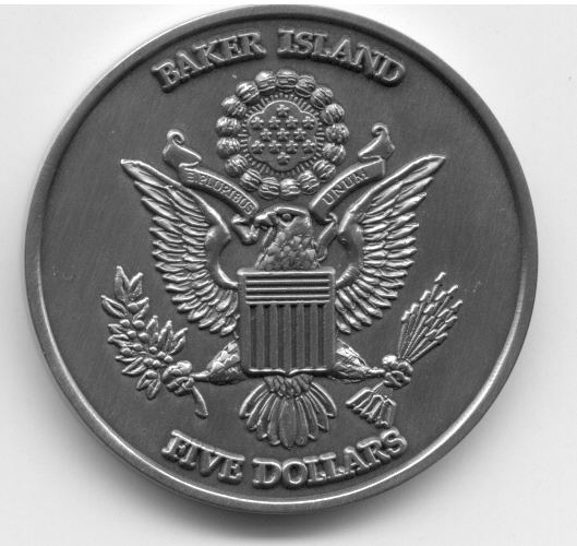
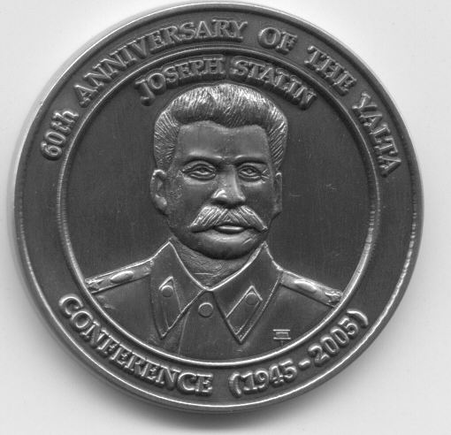
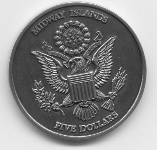
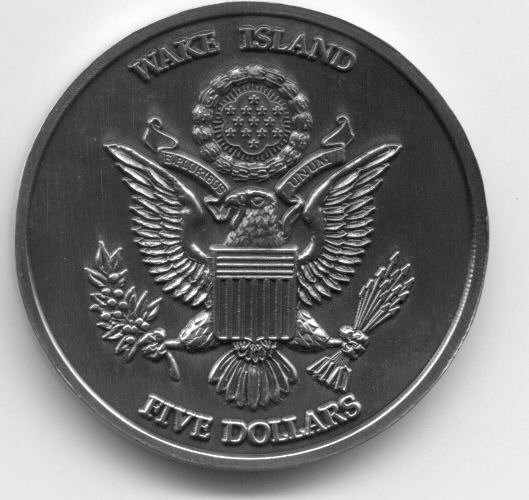
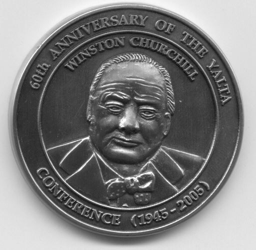
| Each coin is
approximately 1 ounce in weight with plain edge and probably in CuNi metal with antique
touch. Baker Island 5 Dollars 2005
features Russian leader Joseph Stalin. Midway Islands 5 Dollars 2005
features US President Franklin D. Roosevelt and Wake Island 5 Dollars 2005
features UK Prime Minister Winston Churchill. All these personalities
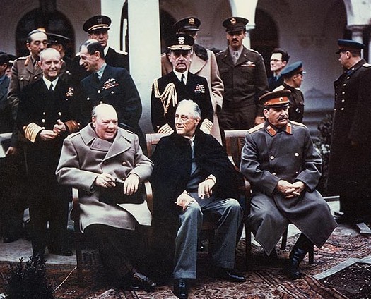
attended Yalta Conference in 1945. These coins commomerates the 60th
anniversary of Yalta Conference. The Yalta Conference, sometimes called the
Crimea Conference and codenamed the Argonaut Conference, was the wartime
meeting from February 4, 1945 to February 11, 1945 between the heads of
government of the United States, the United Kingdom, and the Soviet Union -
Franklin D. Roosevelt, Winston Churchill, and Joseph Stalin, respectively.
On the 4th of February, 1945 the Big Three (Roosevelt,
Churchill, Stalin) convened at Yalta, on the Crimean Peninsula. It was the
second of three wartime conferences among the major Allied Power leaders. It
had been preceded by the Tehran Conference in 1943, and it was followed by
the Potsdam Conference, which Harry Truman attended in place of the late
FDR, in 1945.
Premier Stalin refused to travel farther West than the Black Sea resort of
Yalta, in the Crimea. Each leader had an agenda for the Yalta Conference:
Roosevelt asked for Soviet support in the U.S. Pacific War against Japan,
specifically invading Japan proper; Churchill pressed for free elections and
democratic governments in Eastern Europe (specifically Poland); and Stalin
established a Russian sphere of political influence in Eastern Europe, as
essential to the USSR's national security. |
|
|
| For statistical purposes, Baker, Midway, Wake Islands, etc are grouped as
one of the United States Minor Outlying Islands. |
| |
| |
|
|
|
Micro-Nations |
| |
|
Chiefa Coins |
|
|


